
Fishing without a plan is planning to catch no fish.
With our second in series tournament just 3 days away its time to start figuring out where to go and what to throw on Lake Palestine.
Lay of the Land
When heading to a new body of water it can be incredibly helpful to visualize the area. That’s why my first stop during research isn’t the TPWD Lake Finder, though I’ll be back there soon enough. No, my first stop is to create a new project in Google Earth.
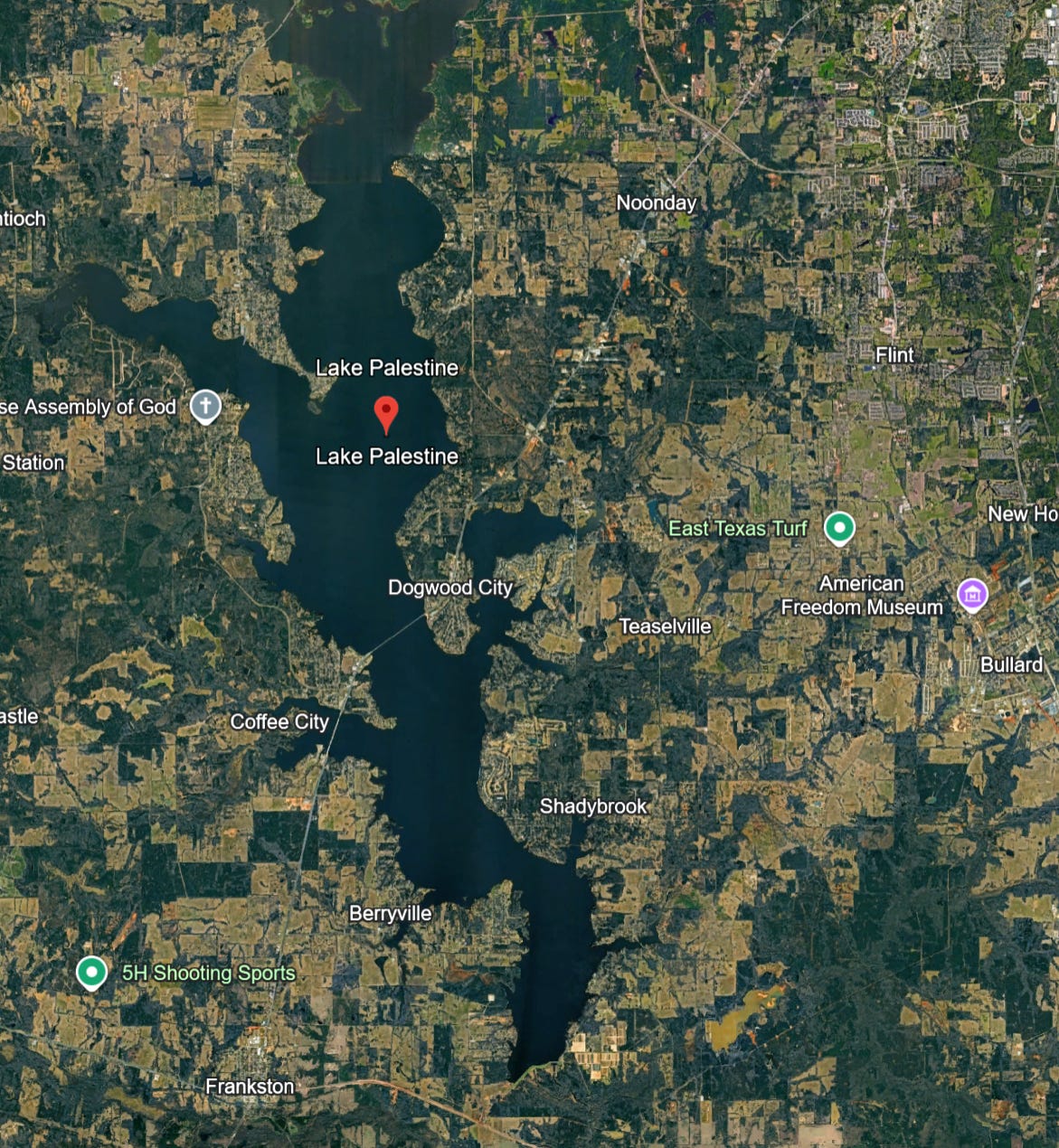
I’ve been a pretty heavy Google Earth user for over a decade, even using it to generate evidence and visuals while working as an expert witness. The new online version is excellent; it is easy to use, looks great, and stores waypoints for later export perfectly.
Because we’ve never been to this lake before, or anywhere in the area, I like to start by marking the locations of where I’m going to stay, where the weigh in will take place, and other boat launches that we could potentially use.
The weigh in station location is found in the event info from THSBA, along with the registration site which in this case is at the local Academy in Tyler, Texas.
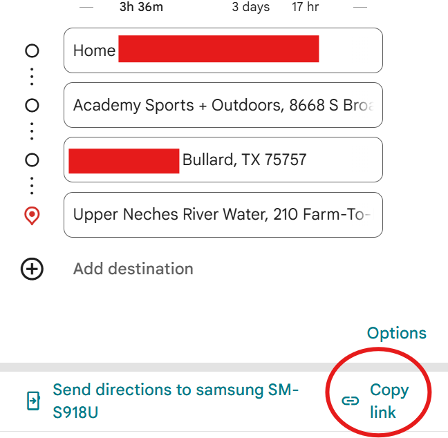
Because these are land travel locations I add them into Google Maps. You can move the waypoints around, copy the route, and text it right to your phone.
Now I start dropping pins into my project, starting with the bay by the weight in station. That way when I later transfer the coordinates to my GPS it will be waiting.
I’m still new to the Garmin and figuring out the best way to transfer data. From what I’ve read it’s important to prefix each mark with the lake you are on.
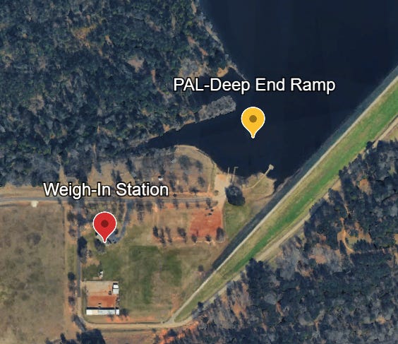
When fishing one of these tournaments you do NOT have to launch at the weigh in station. You just need to make it back there at the end of the day. Depending on where you want to start fishing and what your logistics look like you can launch from anywhere on the lake.
According to my teammate that decision is often made at the last minute the night before. But just so I’ve got some options I’m going to mark a few other ramps.
For those I go to the TPWD Lake Palestine page, which links to public access facilities.
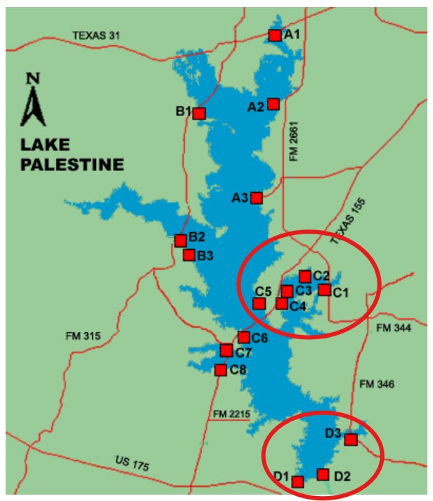
The weigh in station is at D1, so immediately the ramps at D2 and D3 are interesting. And we are staying on the east side of the lake so the C1 to C5 grouping also looks good. And depending on the conditions A1 to A3 are also solid choices, although that would make for a long run back to the trailer at the end of the day.
Scrolling down the page gives info on each. The lower ramps turn out to be no good.
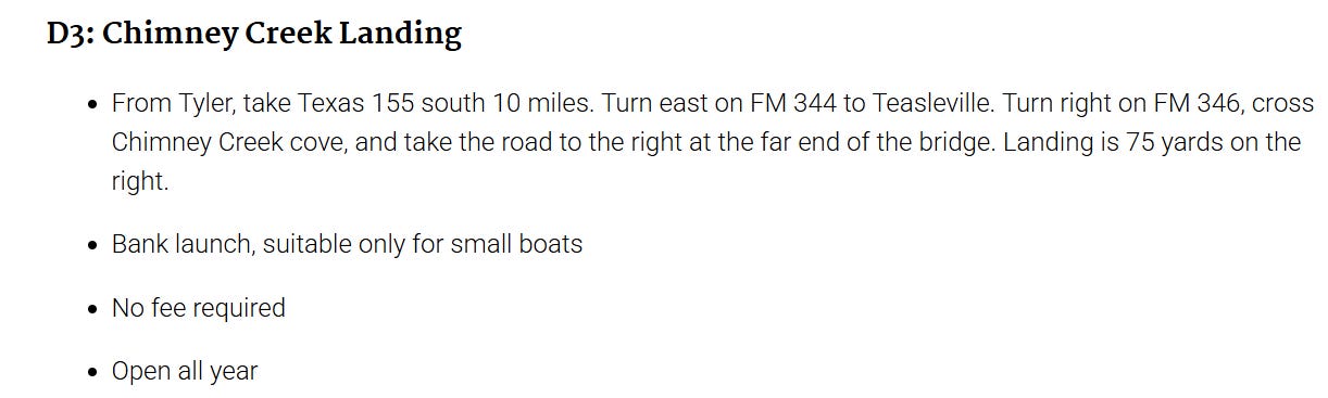
I add a few to the map and it’s time to move on.
From the TPWD lake page:
Fishing Cover/Structure
Most vegetation and inundated timber are located above the Texas Highway 155 bridge in the main lake, Highsaw and Ledbetter arms, in Kickapoo and Neches River arms and in Flat Creek. Anglers have placed brush piles in many locations between the dam and the bridge; these can be found using graph recorders. The bridge itself provides excellent structure on the main crossing between Dogwood and Coffee Cities and over Highsaw/Ledbetter creeks.
Tips & Tactics
Hybrid stripers and white bass are particularly active from the dam to Highway 155 during winter months and into spring. Largemouth bass anglers report greatest success in the upper end of the lake (above the pipeline), in Cobb and Stone Chimney creeks, and Saline Bay.
Good tips right there. But rather than scroll the map looking for those areas, I’m guessing that my trusty Lakes & Bays will list the exact coordinates for these spots.
And does it ever! Nineteen largemouth spots listed, plus nine for white bass and five for hybrids.
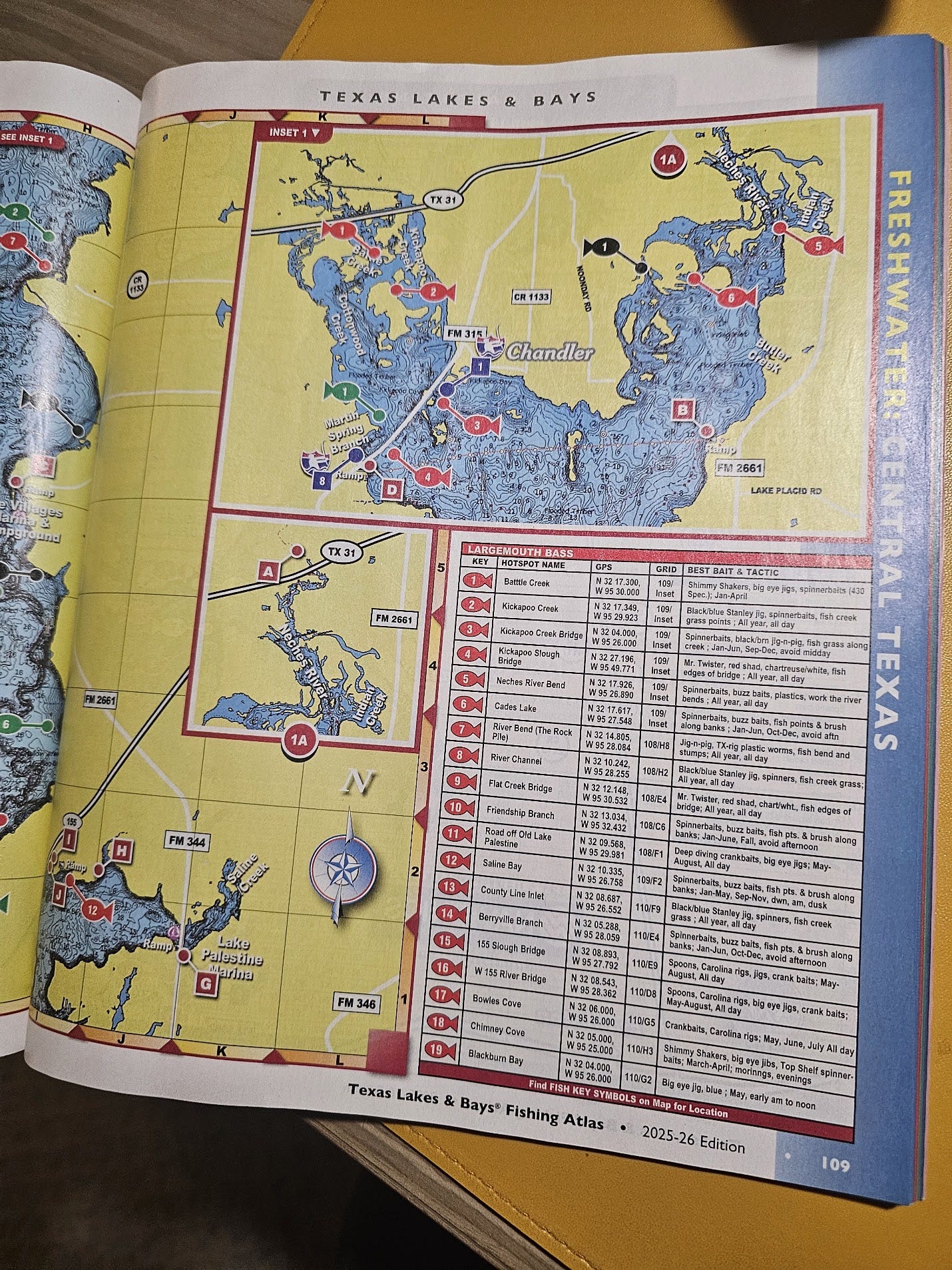
Now this does give me pause though. What do I do with all of this info? Am I just going to dump a ton of spots into my GPS, have it be all cluttered up and still not be sure where to go?
Adding to this is that we won’t typically get the chance to practice on many lakes before the big day. We’ll be getting right into it on day one, and need a fish-catching gameplan immediately. We need options.
And how do you name all of these waypoints. With 25+ locations on the lake I need a system to help make sense of it all.
What I’m thinking is to name them so as to refer back to the guide. Then we’ll just carry that for reference. But this begs the obvious question then, why go through the work of inputting these at all? Why not just carry the guide and call it a day?
I don’t know the answer at this point and as we haven’t fished one of these before I don’t have any personal experience to apply.
But I do know that going through the exercise here at my desk is helpful. Looking at the lakes in depth on Google Earth and reading different sources of info is helping me get an idea of what to expect. Then doing the work of adding data is helping it stick.
Here is what I’m going to do.
Waypoints from the atlas will be named like “PAL-LB-LB-01”.
- PAL – Lake Palestine
- LB – Lakes & Bays Atlas
- LB – Largemouth
- 01 – Waypoint No. 1
Then I’ll carry the atlas for reference, and when making a fishing plan I can just write down the waypoints I intend to hit. And because the atlas lays out waypoints from north to south I’ll also have an idea on where to go even without the guide.
Edit: well I did that and I don’t love it. My waypoint list looks like this:
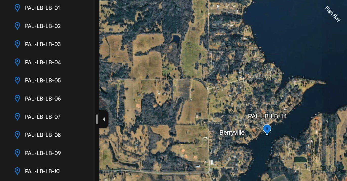
That waypoint no. 14 is the Berryville Branch. I think using the actual names will be the better choice.
*updating names*
Better I think, no?
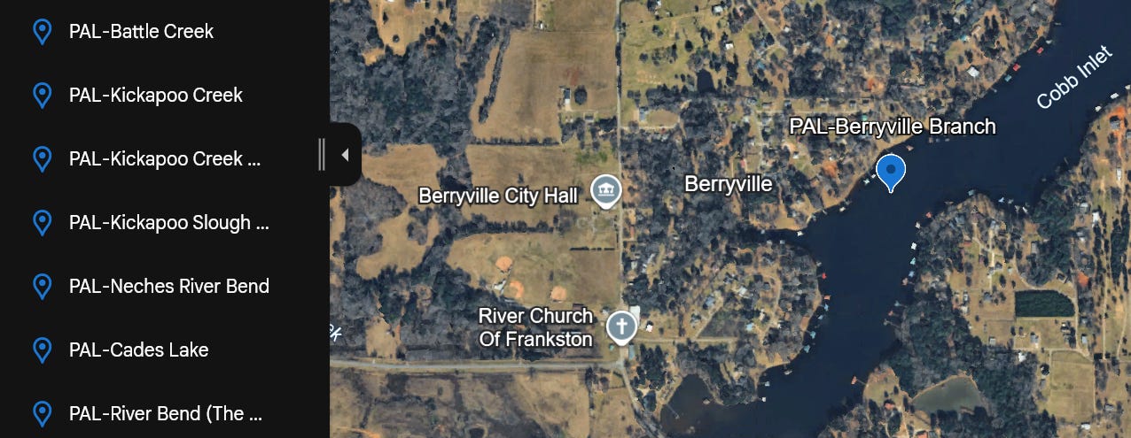
But now I’ve noticed something else. Some of the waypoints are in places I would prefer not to take my boat!
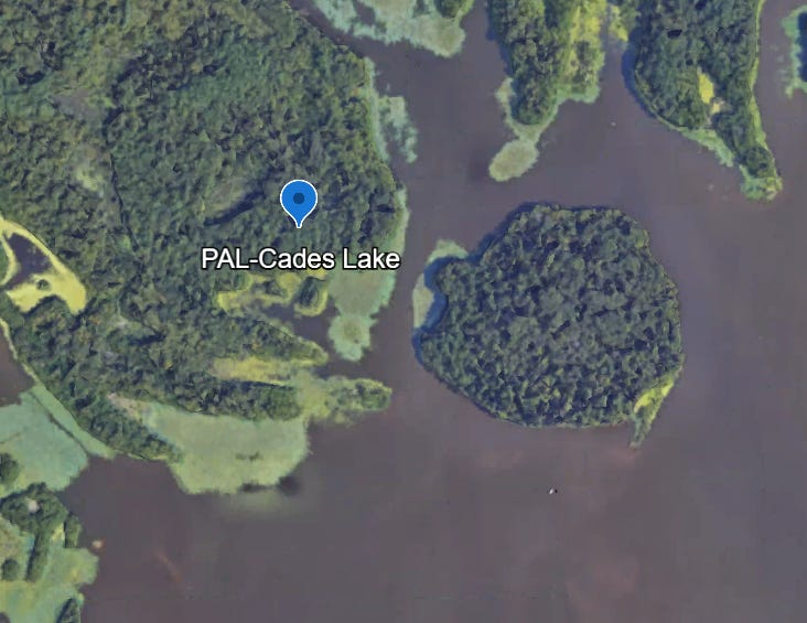
When working at sea we had strict rules about waypoints and using the autopilot. The situation is different here but the sentiment is the same. It is easy to get distracted on the water so validating your data is a must.
I’ll get that cleaned up before adding to my chart plotter.
Where to Go?
Now we’ve got a nice pile of data, but what are we going to do with it?
I don’t think going to all nineteen spots is reasonable. Plus, the descriptions in some say “year round” but others leave out the fall. I’m sure this has to do with migration and the changing of the seasons. I now want to look at the lake strategically and trim down the list to something more manageable.
TPWD says that the upper end of the lake is pretty good, and mentions Kickapoo Creek specifically, so I start looking there.
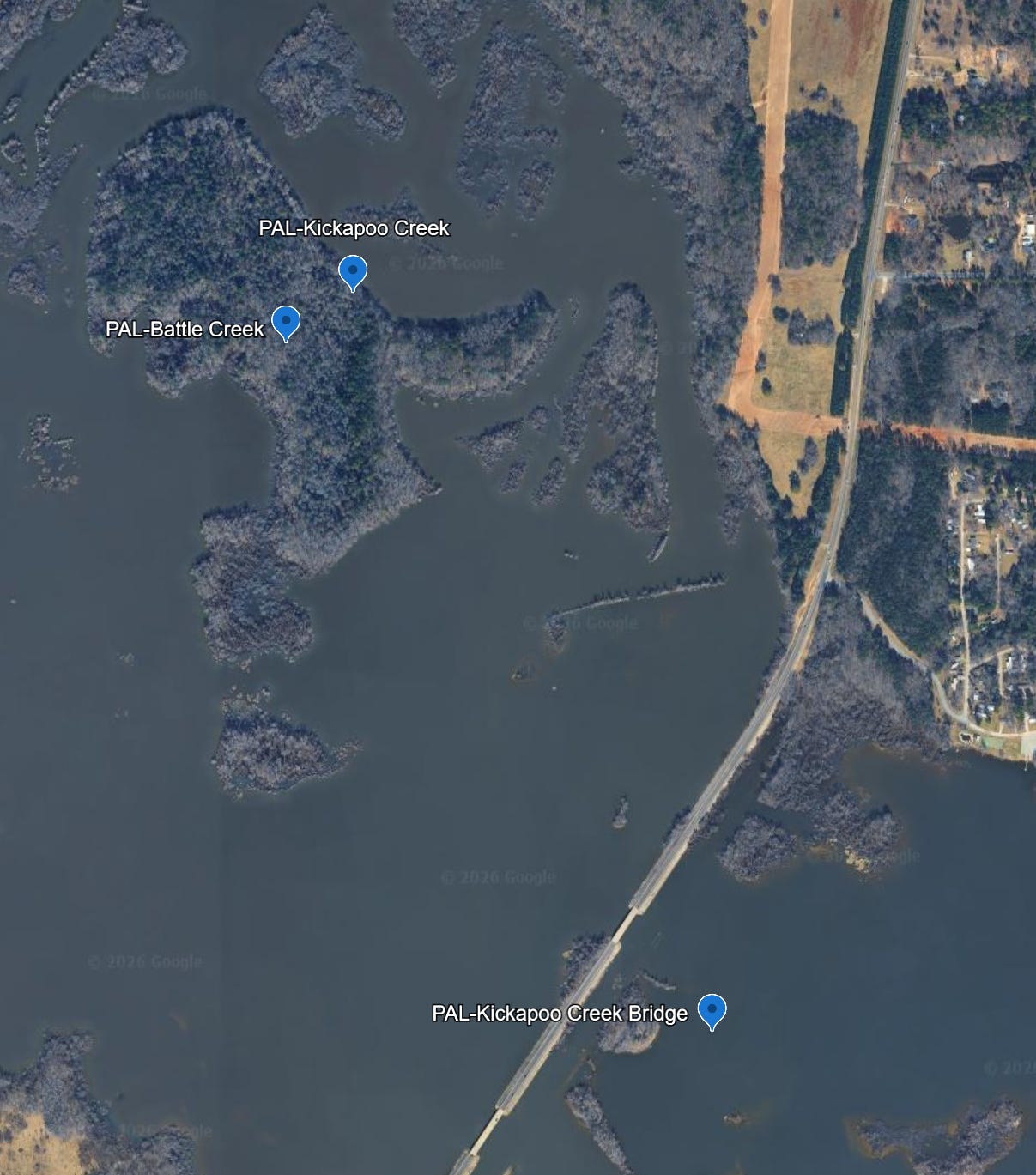
(You can see I’ve still got some waypoints to clean up)
But what is really interesting is when I roll back the historical imagery.
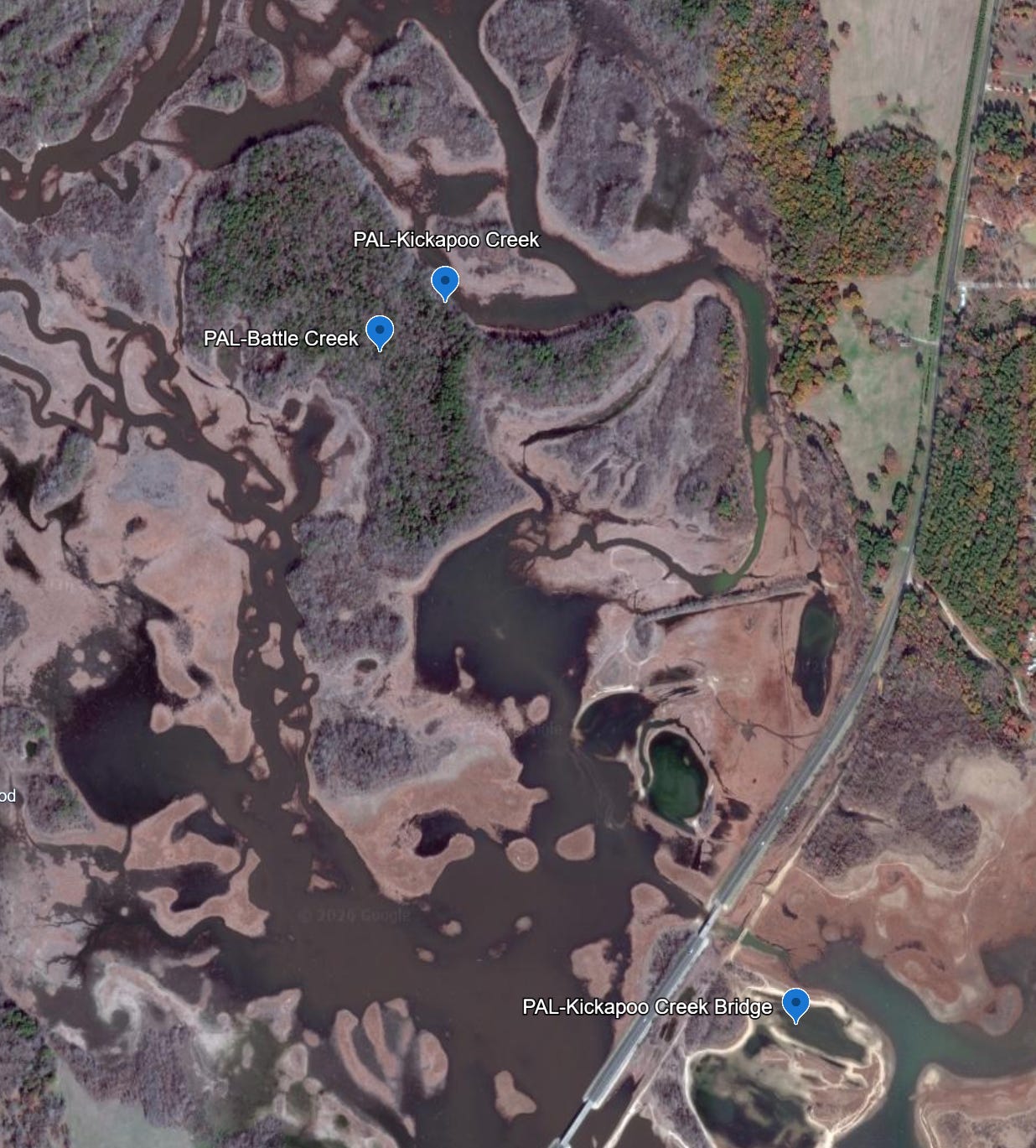
This is the same area in 2012. The water was much lower and the creek beds are much easier to see.
This gets me thinking about water levels and unseen hazards. I’d better get a recent update before making any final decisions.
Getting Stumped
Time to find some local knowledge.
A quick search took me to the Lake Palestine and East Texas Fishing group on Facebook. I was immediately hit with questions about the lake being low and where to run to safely avoid stumps.
Uh oh!
The WaterDataForTexas.org page clearly shows the lake is around 2ft low from its conservation pool level.
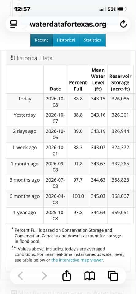
Reading through the discussions online the local opinion are consistent, saying “no way I would run at full speed this time of year” and “further north (than villages resort) use extreme caution”, to “Stay south, your (sic) safe”.
But the overwhelming message was to “stick with the guide lanes.”
Guide lanes?
Local guide Tom Mayne produces guide lane for import into your chart plotter. The “lanes” are essentially safe running areas that will help you avoid forest of barely submerged stumps and other hazards to navigation. As Lake Palestine apparently doesn’t have many marked channels, I bit the bullet and purchased a set.
Now, this could be construed as violating rule 4 of the THSBA rulebook on Purchasing of Information, which prohibits receiving GPS waypoints or purchased info for locating or catching fish five days ahead of the tournament. However, my understanding is that these guide lanes are for getting around the lake safely, and are intended for use as a navigational aid only, without specific fishing spots marked.
Considering the fact that I’ve never been to the lake before and I’d rather not spend the day hung up on a tree stump, I think our safety is worth it. I’m confident that I am not purchasing fishing specific info.
The Final Plan
All of this research over a few days has left me with a few ideas and a bunch of data, but no gameday plan. Time to put it all together.
Considering that this will be the first full-day trip out with the boat I’m going to take this one nice and easy and just stick to the lower end of the lake. That gives a half dozen locations to choose from, and will avoid all of the shallow water stumps I’ve been reading about.
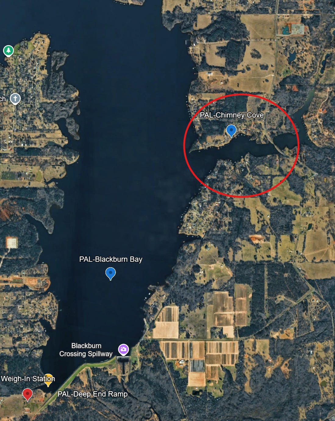
The plan is to start at the mouth of Chimney Cove and work our way in. Depending on where the fish are we’ll then move over to Berryville branch and target the same type of structure over there. After that we’ll move up into Saline Bay then see where we are after that.
I’ve got three locations scouted to launch from: Waters Edge Marina up north, Lake Palestine Marina in the middle, or right at the Deep End ramp where the weigh in will take place. That will be a gameday decision.
What to Throw
Finally, what rods to rig?
Texas Parks and Wildlife suggests spinner baits, crankbaits, big eye jigs and Carolina or Texas rigs.
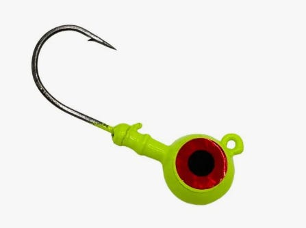
The initial plan is to rig a topwater rod for the morning, a spinner, and a Texas or Carolina to start.
Then, like any good fishermen, we’ll carry a whole bunch of extra stuff that we’ll never use.
Keeping this part super simple.
Easy Wins
This will be the first tournament that we participate in and my ultimate goal is no just have a great day on the water, with no major issues.
It’s a big challenge pulling this all together from scratch, with no boat and no bass fishing knowledge. Just getting on the water with our team is the win for this one.
Catching and weighing in some fish will be a bonus.
Wish us luck.